So here we are in south Florida roasting in the heat of summer. But while the sunny skies may be nice, something crucial is missing in our daily weather patterns. For the last three months, most of south Florida has been lacking a significant amount of rainfall. In particular, the east coast areas including Miami, Fort Lauderdale, and West Palm Beach are in the midst of a high rainfall deficit, some neighborhoods above 20" below climatological values for this year up to date. For that reason, the classification of drought handed down by the National Drought Mitigation Center from the University of Nebraska- Lincoln ranges from D0 (abnormally dry) to D3 (extreme drought).
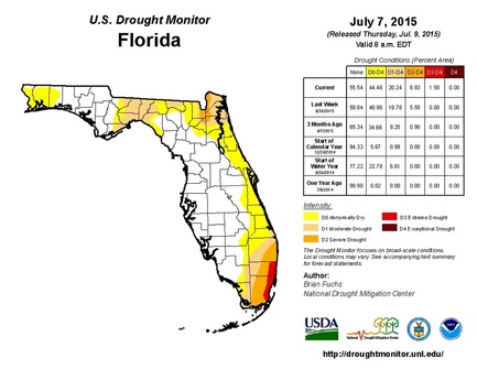
The figure on the left is the image generated by UNL for the entire state of Florida. While most of the peninsula remains drought-free, the eastern half has remained unseasonably dry. Compared to last year, we have seen the growth of and intensification of drought conditions along the Dade, Broward, and Palm Beach county area. Just last week, portions of coastal Miami-Dade and Broward counties were upgraded to a D3 drought which is characterized by major crop losses and regional water shortages. This is a problem for south Floridians because a water shortage raises the threat of salt water intrusion in the Biscayne Aquifer. The aquifer serves virtually all of south Florida's water needs; it is also considered a surficial water layer. Without that, the potential for contamination in our drinking water is higher than normal.
Now, the million-dollar question is: Are we expected to see relief any time soon? I have two answers for that. The short answer is... very little. Unless we see a deluge of rainfall within the balance of the rainy season, we are expected to remain in the drought for a considerable period of time.
Now for the slightly long answer... For the past two weeks, south Florida has been influenced by the large Bermuda high pressure system and a surface ridge to our north. This has kept most of the strong storm systems well to our north, particularly those that have caused severe weather across the Deep South and the eastern Ohio Valley. In addition, the Bermuda High has had a potent grip on our surface winds and aloft as well, with a persistent easterly flow. What this does is steer the convective mechanisms of south Florida, the sea breezes, more towards the interior and west coast areas such as Naples and Fort Myers (notice how they are not involved in any drought index; shown above).
But that is changing, at least according to what the models are saying...
The Global Forecasting System is calling for a change in the mid to upper-level winds of the atmosphere. The most recent North American Model (NAM) run agrees with the GFS and shows mid-level winds will be driven from the southwest for the better part of this week. In addition, this morning's rawinsonde data shows that there is a large amount of instability just after sunrise with a large amount of precipitable water in the atmosphere. These factors coupled together will help to deliver some much needed rainfall to the east coast metro areas. Below are some of the images depicting the patterns:
NAM run (00 to +60 hrs) at 500 mb
Now, the million-dollar question is: Are we expected to see relief any time soon? I have two answers for that. The short answer is... very little. Unless we see a deluge of rainfall within the balance of the rainy season, we are expected to remain in the drought for a considerable period of time.
Now for the slightly long answer... For the past two weeks, south Florida has been influenced by the large Bermuda high pressure system and a surface ridge to our north. This has kept most of the strong storm systems well to our north, particularly those that have caused severe weather across the Deep South and the eastern Ohio Valley. In addition, the Bermuda High has had a potent grip on our surface winds and aloft as well, with a persistent easterly flow. What this does is steer the convective mechanisms of south Florida, the sea breezes, more towards the interior and west coast areas such as Naples and Fort Myers (notice how they are not involved in any drought index; shown above).
But that is changing, at least according to what the models are saying...
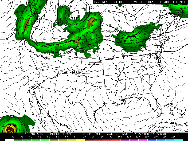
The Global Forecasting System is calling for a change in the mid to upper-level winds of the atmosphere. The most recent North American Model (NAM) run agrees with the GFS and shows mid-level winds will be driven from the southwest for the better part of this week. In addition, this morning's rawinsonde data shows that there is a large amount of instability just after sunrise with a large amount of precipitable water in the atmosphere. These factors coupled together will help to deliver some much needed rainfall to the east coast metro areas. Below are some of the images depicting the patterns:
NAM run (00 to +60 hrs) at 500 mb

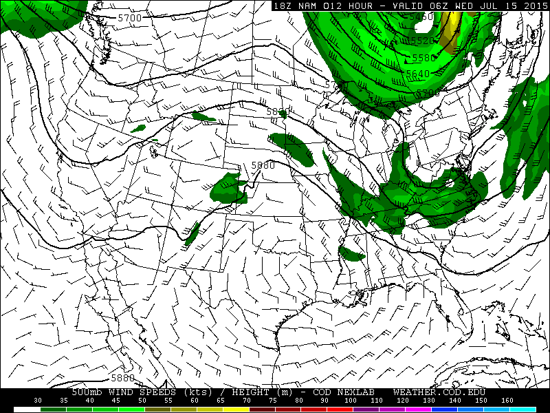
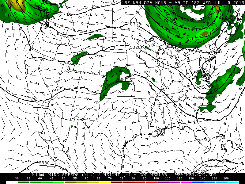
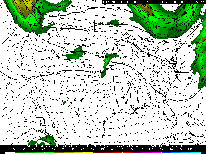
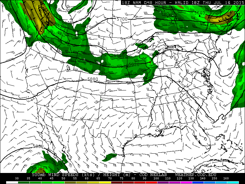
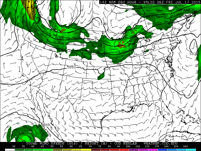
The NAM run continues the west to east propagation of wind flow through the next two days.
GFS run (00 to +60 hours) at 500 mb:
GFS run (00 to +60 hours) at 500 mb:
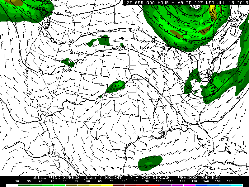

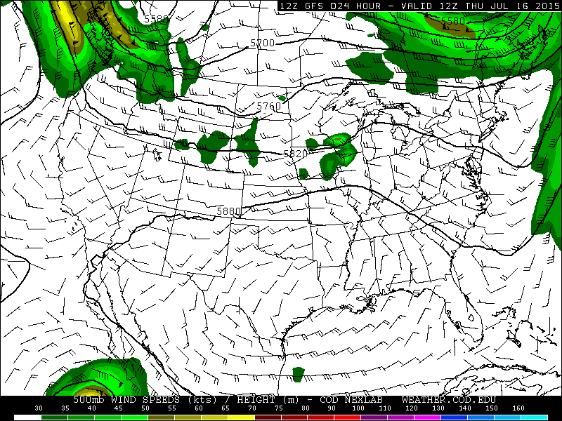
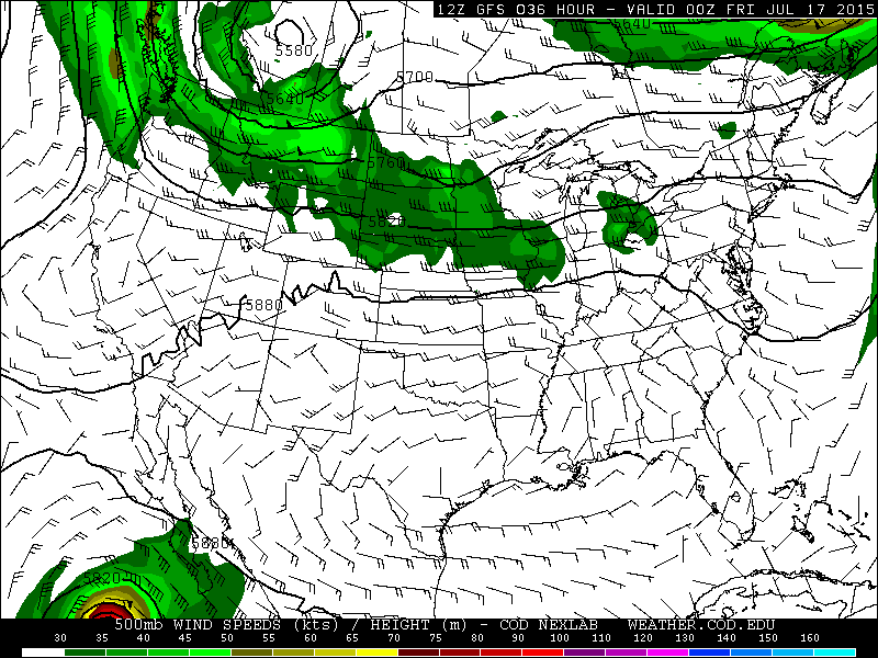

The GFS also agrees with the westerly flow and keeps it until about Friday where the mid-level winds are expected to shift to an east to west movement by the weekend.
The National Weather Service is calling for a regional chance of precipitation this week from 40-70%, which means scattered to numerous thunderstorms are expected across the coverage area. We can only hope that even a small amount can help. We will have to find out more as we progress through the rest of the month.
Happy Wednesday everyone!
*All images obtained from the following locations:
Drought monitor: University of Nebraska-Lincoln (http://droughtmonitor.unl.edu/Home/StateDroughtMonitor.aspx?FL)
Model outputs: College of DuPage (http://weather.cod.edu/forecast/)
